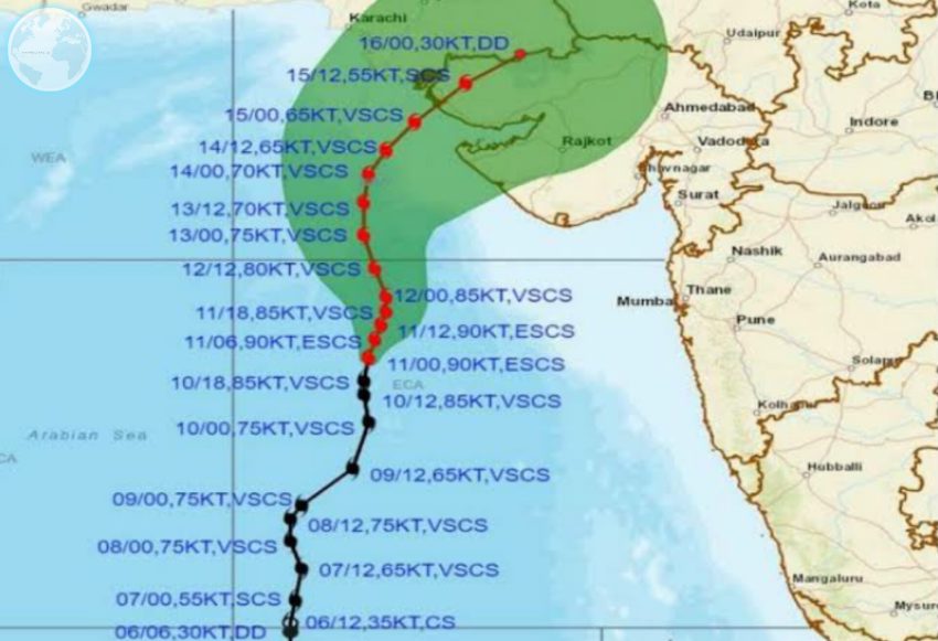
The Cyclone Biparjoy is currently about 350 km away from Karachi and may enter south of Karachi anytime.

The NDMA said that the cyclone has remained at a distance of about 360 km from Thatta and 300 km from Keti Bandar.
Apart from this, he also said that after staying north, the cyclone will turn north-east on June 15 and Kati Bandar will pass over Indian Gujarat.
Let us tell you that looking at the waves of the sea, it seems that the coastal areas of Sindh may get flooded.
Along with this, Chief Meteorologist named Sardar Sarfaraz said in the Geo News show that this cyclone has decreased and therefore the situation in Karachi is not dangerous because this storm is south of Karachi.
He further said that this storm will pass through Indian Gujarat and Keti Bandar, while there is a possibility of light rain in Karachi today, but there is also a possibility of heavy rain in the city on June 15 and 16.
On the other hand, the effects of the cyclone are beginning to be noticeable on the Karachi beach and people are coming to the beach because there is no administration to stop the people.
Apart from this, NDMA said that there is a risk of severe flooding in many areas of Sindh, including Kemari, Korangi and Thatta districts of Karachi due to this storm.
He also said that strong winds will blow in Karachi division, Hyderabad and Mirpur Khas, while the speed of winds will also be high on the coast and there is a possibility of heavy rains.
Due to this storm, the communication system may be interrupted in the coastal areas.
